Cape Town's 8 most-driven routes, ranked by safety
Honest guidance for visitors — no fearmongering, no sugarcoating.
The brief
This guide exists because most "is Cape Town safe?" advice on the internet is written by people who have never driven here, or who visited once a decade ago. I drive these eight routes nearly every week — to the airport before sunrise, up Chapman's Peak for client shoots, out to Stellenbosch on Fridays, down to Boulders with visiting family. Nothing in the next eight cards is generic.
The safety scores combine three inputs: SAPS Q3 2025 crime statistics for the policing precincts each route passes through, the CCID and Atlantic Seaboard incident logs published monthly, and the lived knowledge of a few dozen drivers, guides and Uber operators I asked before writing. Where I cite a specific time, road or behaviour, it is because the data and the locals agree.
Cape Town is a magnificent driving city. It is also a real one, with uneven risk by neighbourhood and hour. Read the cards, follow the timing notes, and you will see the city the way the people who live here do — with confidence, not fear.
The eight routes
Ranked by combined safety and ease of driving
01
Cape Town International Airport → V&A Waterfront
Distance
22 km
Typical drive
25–45 min
Safety
●●●●●
Best time
06:00–08:00 and 10:00–15:00
Take the N2 west and exit at Hospital Bend onto the M3, then drop down via Eastern Boulevard (M4) into the city — it is the route every metered cab and Uber uses and the one with the most CCTV coverage. Avoid the temptation to follow Google Maps if it tries to reroute you through Settlers Way side streets during congestion; SAPS Q3 2025 figures still flag Borcherds Quarry Road and the Airport Approach Road for smash-and-grabs at red lights, almost all between 18:00 and 04:00. Keep windows up, bags out of sight on the footwell, and if you must stop, the Engen 1-Stop just before the N2 split is well-lit and staffed 24/7. Pre-booked airport transfers and Uber/Bolt are markedly safer than walking out to long-stay parking after a late landing.
Avoid: Evening rush 16:30–18:30 and after dark
02
V&A Waterfront → Camps Bay (Sea Point coastal route)
Distance
9 km
Typical drive
20–30 min
Safety
●●●●●
Best time
Any daylight hour; sunset 17:30–19:30 is the highlight
Follow Beach Road through Mouille Point and Sea Point, hug the coast along Victoria Road past Bantry Bay and Clifton, and you arrive in Camps Bay. This is the safest tourist drive in the city — the Sea Point Promenade is patrolled by CCID officers and the road is busy until late. Parking on Victoria Road in Camps Bay is metered and watched by registered car guards in bibs (a R10–R20 tip is standard, never pay anyone without a bib). The two pinch points are Queens Beach parking and the Clifton 4th steps lot, where bag theft from boots happens in summer — never leave anything visible. Avoid the temptation to short-cut over Kloof Nek at night with the car unlocked at a viewpoint.
Avoid: Late night after 23:00 when Camps Bay strip empties out
03
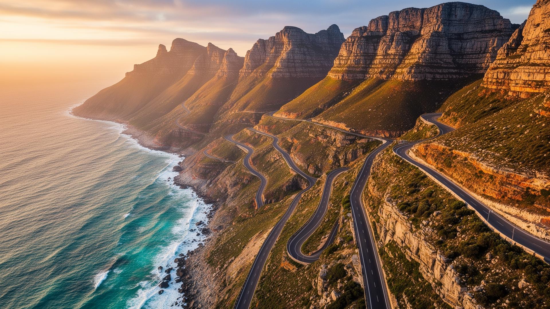
Camps Bay → Hout Bay (Chapman's Peak Drive)
Distance
17 km
Typical drive
30–45 min
Safety
●●●●●
Best time
Mid-morning 09:00–12:00 for light; late afternoon for photos
Victoria Road south through Bakoven and Llandudno, then the toll booth at the start of Chapman's Peak (R66 per car, card accepted). The drive itself is one of the safest in the country: tolled, gated, regularly patrolled, with formal viewpoints. The only real risks are weather closures (check chapmanspeakdrive.co.za before you leave) and tourists stopping in the lane for photos — use the marked lay-bys only. In Hout Bay itself, park at the Harbour or Mariner's Wharf rather than on side streets; opportunistic theft on Princess Road and around the Hangberg turn-off remains on SAPS Q3 2025 watchlists. Do not drive the Chapman's section at night: it is unlit and the road surface is unforgiving.
Avoid: After dark — the road closes in poor weather and rockfall
04
Cape Town → Stellenbosch (winelands)
Distance
50 km
Typical drive
40–60 min
Safety
●●●●●
Best time
Morning 09:00–11:00, returning before 17:00
N1 east, exit 39 (R310 Stellenbosch). The N1 itself is well-policed and the R310 through Koelenhof is straightforward in daylight. Two concrete cautions: first, do not stop on the N1 hard shoulder for a 'flat tyre' flagged by another motorist — staged breakdowns targeting hire cars are a recurring SAPS bulletin item on this stretch. Second, if you are wine-tasting, book a driver. Stellenbosch traffic officers run regular roadblocks on the R44 and R310 on Friday and Saturday evenings and the legal limit is 0.05 g/100ml — effectively one small glass. Park inside estate gates rather than at roadside pull-offs, and keep tasting purchases in the boot from the first stop onward. Return via the N2 if you finish late; it is better lit than the R310.
Avoid: Friday 16:00–19:00 return leg; any time after dark on the R310
05
Cape Town → Cape Point
Distance
70 km
Typical drive
1h 15–1h 45
Safety
●●●●●
Best time
Leave by 08:30 to beat tour buses; aim to exit park by 16:00
The scenic way is M3 → Boyes Drive → Main Road through Muizenberg, Kalk Bay and Simon's Town, then the M4 into the Table Mountain National Park. It is a beautiful, well-trafficked tourist corridor. Two specifics: baboons on the road between Smitswinkel Bay and the park gate are not a cute photo op — they will open an unlocked door and ransack the cabin in under a minute. Keep windows up, doors locked, never feed them. Inside the reserve the speed limit is 40 km/h and strictly enforced. On the return leg, the stretch of Main Road between Muizenberg and Lakeside has had a steady trickle of vehicle break-ins at the surfers' parking; if you stop at Surfers Corner, use the paid lot with car guards rather than the free verge.
Avoid: Late afternoon return on M65 with baboons on the road
06
Cape Town → Boulders Beach (penguins)
Distance
42 km
Typical drive
50–70 min
Safety
●●●●●
Best time
Weekday mornings 08:00–11:00 to avoid coach tours
Same M3 → Main Road corridor as Cape Point, ending at the Boulders SANParks gate in Simon's Town. This is among the safest day trips you can do — the route runs through busy, walked-in suburbs the whole way. Park in the official Boulders lot (R20, monitored) rather than on Bellevue or Kleintuin Road, where boot break-ins do happen on busy days. The naval town of Simon's Town has a visible SAPS and Navy MP presence; petty theft is the main concern, not anything more serious. If you continue south of Simon's Town toward Miller's Point in the afternoon, refuel before you leave — there is no fuel between Simon's Town and Scarborough on the M65 loop.
First cable car 08:00–09:00, or after 16:00 for sunset
Up Kloof Nek Road from the CBD, right onto Tafelberg Road, park at the lower cableway station. The drive is short and uneventful; the safety issue is parking and pedestrian behaviour. The official cableway lots fill by mid-morning in season and overflow parking spills along Tafelberg Road — that overflow stretch is where almost every reported incident happens, typically smash-and-grabs on unattended cars between 10:00 and 14:00. Either arrive early enough for the main lot or use the official MyCiTi shuttle from Camps Bay / Civic Centre. Never start the Platteklip Gorge hike alone, and never walk back down Tafelberg Road to your car at dusk — muggings on the lower contour path are the single most consistent crime on the mountain.
Avoid: Walking down Tafelberg Road after dark
08
Cape Town → Hermanus (Garden Route start)
Distance
120 km
Typical drive
1h 30–2h
Safety
●●●●●
Best time
Depart 08:00–09:00; whale-watching season Jun–Nov
N2 east over Sir Lowry's Pass, exit at Botrivier onto the R43 to Hermanus. The N2 between Somerset West and the Houw Hoek farm stall is well-policed and a pleasure to drive; the Sir Lowry's viewpoint at the top of the pass is a legitimate stop with a guarded parking area. The two practical warnings: the stretch of N2 between Macassar and Sir Lowry's has periodic stone-throwing incidents at dusk from the informal settlements bordering the highway — drive in daylight and keep the centre lane. Second, fill up at the Engen at Houw Hoek; fuel stops thin out after that. In Hermanus itself, park along the cliff path or at Gearing's Point; both are busy and watched. Avoid the unlit R43 return leg at night — leave by 17:00 in winter.
Avoid: Returning after dark on the R43 past Botrivier
Frequently asked
Is it safe to drive in Cape Town as a tourist?+
For the most part, yes. The tourist corridors covered in this guide — the Atlantic Seaboard, Chapman's Peak, the False Bay coast and the N1/N2 to the winelands — are well-policed and busy. Risk is highly time-of-day and location-specific. Drive in daylight, keep valuables out of sight, never stop on highway hard shoulders for strangers, and you will have an uneventful trip.
Should I rent a car or use Uber and Bolt?+
For short city trips, Uber and Bolt are cheap, plentiful, and remove parking and break-in risk entirely. Rent a car when you want to do Cape Point, Chapman's Peak, the winelands, or Hermanus — Uber to those destinations is expensive and one-way. Both services operate at the airport and Waterfront 24/7.
Which areas should I avoid driving through?+
Per SAPS Q3 2025 data, the corridors with the highest vehicle-crime rates are the M5 between Athlone and Manenberg (especially after 20:00), Borcherds Quarry Road around the airport at night, and the N2 through Nyanga. None of these are on the standard tourist route. If your GPS suggests a shortcut through unfamiliar suburbs at night, ignore it and stick to the highway.
What do I do if I'm pulled over by police?+
Legitimate SAPS and traffic officers will be in marked vehicles and uniform. Stop somewhere well-lit and populated — you are entitled to drive a short distance to a petrol station before pulling over. Do not pay any 'on-the-spot fine' in cash. Ask for a written infringement notice; real ones are paid later by EFT or at a designated office.
Is load-shedding still a problem for drivers?+
Less than in 2023–24. Traffic lights at major intersections in the tourist corridors are now mostly on battery backup, but residential intersections still go dark during outages. Treat every dark intersection as a four-way stop. Check the EskomSePush app for the day's schedule before long drives.